

There are a number of ways to access these walking tracks down to Minnatonka Falls and onwards to the Red Gum Picnic Area a bit further on, I entered from the end of De Quency Rd, this track starts at the end of the road next to a sign, the alternate is on Boronia Rd, again marked with a large sign mentioning Red Gum Park. Both are easy walks in and do not take more than 5 minutes before they join up. On the occasion I did this walk, the Boronia Rd entrance is blocked as the bridge across Minnatonka Creek above the falls has been damaged by flood, yes you could just step across the creek as the bridge is not needed in most conditions.
On the way in from De Quency Rd, not long after you start this walk, there is a bower bird nest/bower on the right of the track, lots of blue items scattered around the bower, very cool to see, but please leave it alone. A bit further on where the track takes a left, there is a little rocky outcrop with filtered views over the valley, not a lot to see, but one of the few views on this walk. Another few minutes and you arrive at the intersection with the track from Boronia Rd, a barrier is in place warning the bridge is out when I was here.
Continuing down, another intersection and if you turn left, you will arrive at Minnatonka Falls 5 minutes later, this track can be a bit over grown and muddy after rain, not to mention the occasional leach to be flicked off. You cross the creek before arriving at the falls, the creek seems to be lined with some horrid sticky black mud, not sure what it is actually made of but does not look too appealing. The falls don't seem to usually have much flow, after rain it seems to flush through quickly and return to a low flow, there was enough flow to at least get some pictures.
Return back to the last intersection and either go right to return to the start of the walk, or go left to head down to Red Gum Picnic Area which is about 10 minutes or less away. The track (assuming you are on your way to the picnic area) slopes down gently till you round a corner and need to cross a creek, this is done via sandstone steps and stepping stones in the creek making for an easy crossing. You pass a sign pointing back to Minnatonka Falls up against a tree and then a track comes in from the right, just keep going straight onwards. This sidetrack, after rain acts like a creek, feeding run-off onto the main walking track, turning it into a small creek and being very wet underfoot.
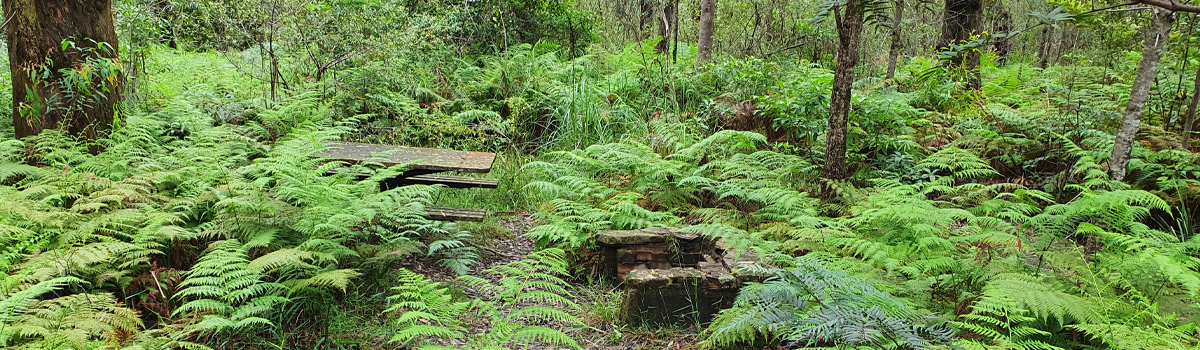
After a few hundred metres, you will pass a sign post on your left, but the actual sign is long gone, 30 seconds later you arrive at the old picnic ground where you will find 3 tables and 2 old BBQs, I highly doubt many people use these anymore. Stop, have a rest, have a bite to eat and a drink, check for leaches (Just to be sure). When you are ready, you can return the same way, or, continue through the picnic ground to an old road, you can go left or right, going left is a long walk that eventually can bring you out at the end of Boronia Rd, so turn right and start to walk up this old road for a bit.
If you choose to, you can just follow this and eventually you will end up on Cottle Rd, or, you can keep an eye out for a track on your right, with an old metal sign post, once again, sans actual sign, this track is the track that feeds the water down onto the main track, follow this for a hundred mtrs or so and you are back on the main track, turn left and you are crossing the creek again with the sandstone steps. From here, retrace your original route back to your starting point.
An easy walk for all ages, best done after rain if you want to see the falls with any reasonable flows, just be mindful of leaches, I got 3 on my walk. All up, you could do the whole circuit in about 30-40 minutes if you wanted.


