Mt Victoria Falls Carpark to Lockley Pylon Carpark
Neither myself or my walking companions had ever done any of the starting sections of this walk, I had been to lockley Pylon a few times, but never entered or exited the valley that way, it was time to go experience somewhere new and May in the Blue Mountains can turn on some spectacular walking weather, the day we did this walk was no exception, the day was truly stunning...
Basic Walk Information
One Way Distance: 20km's
Time One Way: 11 hours (Including breaks and lunch)
Starting Altitude: 987mtrs
Highest Altitude: 987mtrs
Lowest Altitude: 298mtrs
Directions on how to get there
We started from the Mt Victoria Falls Lookout car park at Mt Victoria. Coming from Blackheath, just before you get to Mt Victoria and cross the railway line, there is a signposted turn to the right for Mt Victoria Falls Lookout, take that and follow it to the end, which is around 5 or so km's.
The Walk
Sat, 19th May, 2012, 4:50am, Wingnut, my son John-Luc and our grader driver Darren were all assembled out the front of my house on a very crisp and dark Saturday morning, not much point sitting around so we headed off towards the mountains and around 6am we were on the Mt Hay road heading to the Lockley Pylon car park to leave my car there to await our return. The moon was just spectacular in the inky blue sky, it was just so clear, not cold, but cool, it was going to be a good day for walking.
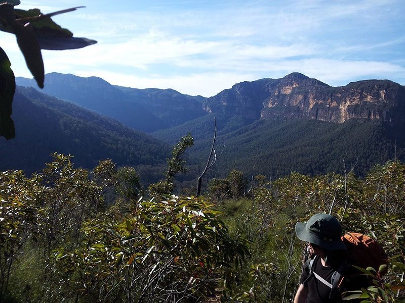
With the car dropped off, we piled into Darrens grader and started our trip around to our departure point at the Mt Victoria Falls lookout car park, bye the time we arrived, the sun was well and truely on it's way up into the sky. Both John-Luc and myself are wanting to start doing some overnight hikes when it gets warmer, so we had larger packs on with around 14-15kgs each in our packs, just to get a decent walk in with that sort of weight. Darren did not stick around very long, so, we shouldered our packs and headed down to the lookout to get a view of where we were heading down into.
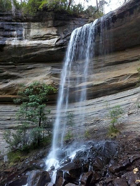
Of course from here, you cannot see the actual falls, it takes quite a while to descend down into the valley below to get to both of the falls, but it sure is worth it! It is very muddy in places and quite slippery too and it took us around 40 minutes to zig zag our way down to the top cascades, which are a short 5 minute detour from our route, just stunning. Continuing on down, we came to the main drop and once again, zig zaged our way down to the base of those falls, this drop is around 50-60 feet high I would guess with a single drop over a unique "shelf", again, another highlight of the walk.
Not much further down from here, the signs tell you that the main track ends at Victoria creek and it is a rough track from here onwards, we walked across a shallow shelf section and found the track on the opposite bank and yes, initially the track is rough, but easily walked even with large packs on. Around 8:37am we walked into Burra Korain camping area to be greated by a number of large groups of campers spread throughout the camping areas there. A quick chat to one of the groups and we were on our way, we crossed Victoria Creek twice and then we were on the western bank of the Grose River.
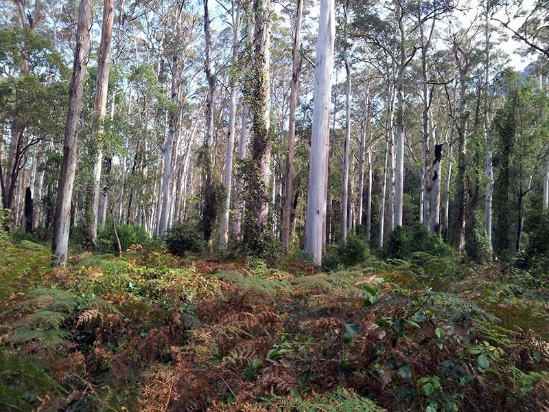
The distance from Burra Korain to the 4 ways in Blue Gum Forest is around 9.6km's and we noted 4 small but good campsites spread along that distance, based on how many people we heard camping at Acacia Flat, one of these campsites is much preferable indeed. At some point along the walk, you will pass below the spectacular Hanging Rock formation on your right, though the views are very much filtered by trees. Plus, if you know just where to look, you can also see one of the best abseil trips in the mountains - Mirrorball on your left.
The whole distance from Burra Korain to Blue Gum Forest is a pretty gentle grade that very slowly drops down, there are a number of creeks to cross but otherwise it is pretty easy going.
At the junction with Pierces Pass, we seemed to have "lost" the track for a few minutes, a well worn track seemed to go "high", but then is gone, so we backtrack 10 or 20 mtrs and then went low where we found the actual track at river level.
The sun was still not fully over the cliffs as yet and we were sweating bigtime, so off came the thick layer and we just walked in thermal tops for the remainder of the day. Sections of this part of the track are at the moment quite muddy and a bit over grown, you also need to watch out for sneaky lawyer vine in many places as it lies in wait to trip you up! But, we did not encounter a single leach the whole trip!
We stopped here and there to have something to eat or a drink, and to generally soak up the atmosphere of walking along the beautiful (Though polluted) Grose River, we really were in no hurry at all and I was happy with our general pace that we were travelling at. The GPS was telling us approximately what time we were going to arrive at the Blue Gum forest, so we were doing ok time-wise.
Finally the grand Blue Gums started to come into view, they really do look pretty amazing standing so white and tall, it is just a pity the valley floor is so over grown by ferns and nastier undergrowth. We finally arrived at the 4 ways at the base of Perrys Lookdown around 1pm where we met a couple having lunch, we chatted for a while until they started their ascent of Perrys Lookdown. It was during this period that we were chatting that Darren appeared after descending via Perrys Lookdown, he waved and headed off towards Acacia Flat.
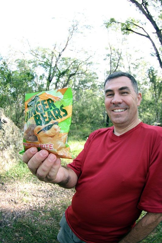
We soon followed and caught up with him where he was having lunch, we were happy to drop packs and have lunch ourselves while we gazed up at our intended exit route, never been up or down that route so it was going to all be new to us. After a reasonable lunch and some Ginger Bears, we once again, shouldered packs and returned to the 4 ways and turned right towards the creek to pickup the track we needed.
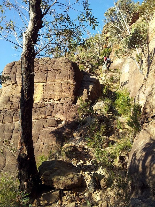
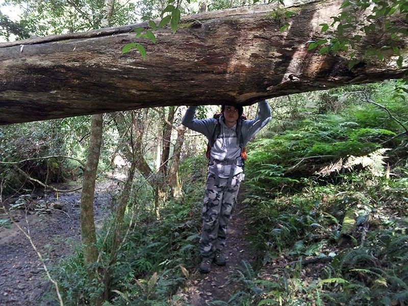
When you arrive at the creek flats, turn left and follow the track that way, you will eventually come to a large fallen tree that has evidence of people walking on it, cross it with care and then take the track on the otherside to the left, turning right will take you back to the creek. In about 3 minutes, the long ascent is going to start up to the base of the cliffs and the final quick section to the top of the actual cliff line.
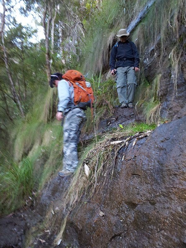
This track is well defined, rough in places and has lots of wonderful holly to tickle those in short sleeves, the track winds its way up the skirt to the base of the cliffs. I really hate my hills, and carrying more than usual meant I made a number of stops to ensure my legs did not cramp up, at least it is shady in places, but for me, the slope just kept on going and going and going! Wingnut had already got a ways in front of John-Luc and myself, we could hear him occasionally ahead yelling out what was coming up.
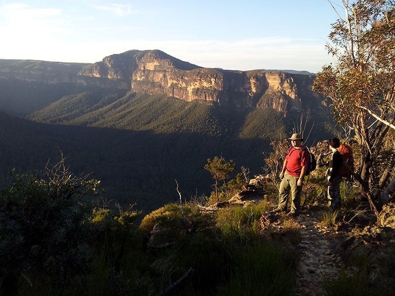
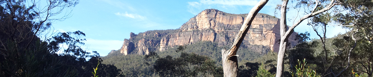
Finally, we made it to the base of the cliffs after one hour and 47 minutes of climbing and resting as we conquered that skirt, I had a good rest and a good drink and prepared myself for anything that lay ahead. I was actually surprised at just how good the track up through the cliffs actually was, there were steps in places, some cut into place, it only took me about 18 minutes, again with my usual stops, to make the final climb to the top. At least the views were spectacular each time I stopped and rested on the way up.
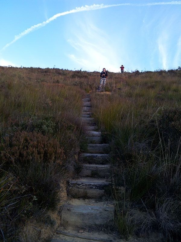
Some photos were taken and we started the rest of our trek across to the base of Lockley Pylon, the track is easy to follow most of the time, and logic will tell you where the track goes up rocky bits. We got to follow the edge of the cliffs for a distance giving awesome views in the fading light, but then we had to turn away from the valley and start to head towards Lockley Pylon. It is here that the long flight of wooden steps takes you up the final hill to the base of Lockley Pylon, not much fun really after such a long day.
We reached the stairs to the top of lockley Pylon at around 4:46pm, having been to the Pylon a number of previous times, and with the sun fast going down, we just rested for a few minutes and then started the final part of our journey to the Carpark where our car awaited us. As we walked away from Lockley Pylon, we met our only walking couple we actually met on the track, they were going to camp at the Pylon Sat night and then descend into the valley the next morning.
The walk from Lockley Pylon back to the car park is an easy undulating walk, a bit rough underfoot in places and around halfway back, we had to break out the head torches as it was just getting too dark to see properly. Finally, in total darkness at around 5:52pm we broke through the last few trees and arrived at the carpark. Was I so glad to find some "shower in a can", as I doubt any fast food joint would have let us walk in with the way we smelt from sweating all day.
This is a great walking trip, the views are amazing of both the cliffs and all along the river and let's not forget the spectacular waterfalls at the start, plenty of places to camp along the way, and really is a great long day out and really worth doing if you can get the car shuffle to do it.
Elevation Profile

Image Gallery